Flush Bracket, Derriaghy
Introduction
The photograph on this page of Flush Bracket, Derriaghy by Rossographer as part of the Geograph project.
The Geograph project started in 2005 with the aim of publishing, organising and preserving representative images for every square kilometre of Great Britain, Ireland and the Isle of Man.

There are currently over 7.5m images from over 14,400 individuals and you can help contribute to the project by visiting https://www.geograph.org.uk
Flush Bracket, Derriaghy
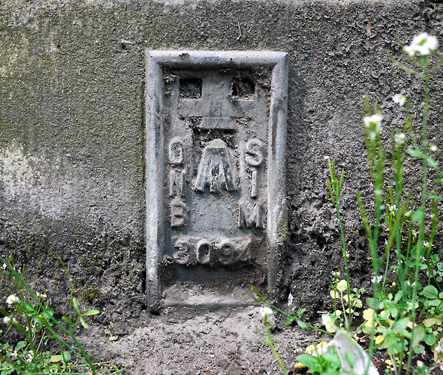
Image: © Rossographer Taken: 28 Apr 2010
Flush bracket on the bottom right hand side of the pedestrian tunnel under the railway bridge at Derriaghy on the Belfast to Lisburn Road Image It was caked in mud and almost invisible so I had to give it a good clean. The number on the bracket is OSNIBM 3094. The mark is 28.88 metres above MSL. A flush bracket is a type of bench mark set onto the face of a building. See also http://www.geograph.org.uk/search.php?i=11037856 for many other examples I have found.
Images are licensed for reuse under creativecommons.org/licenses/by-sa/2.0
Image Location
Latitude
54.542713
Longitude
-6.017063