Fairfield Low barrow
Introduction
The photograph on this page of Fairfield Low barrow by Richard Law as part of the Geograph project.
The Geograph project started in 2005 with the aim of publishing, organising and preserving representative images for every square kilometre of Great Britain, Ireland and the Isle of Man.

There are currently over 7.5m images from over 14,400 individuals and you can help contribute to the project by visiting https://www.geograph.org.uk
Fairfield Low barrow
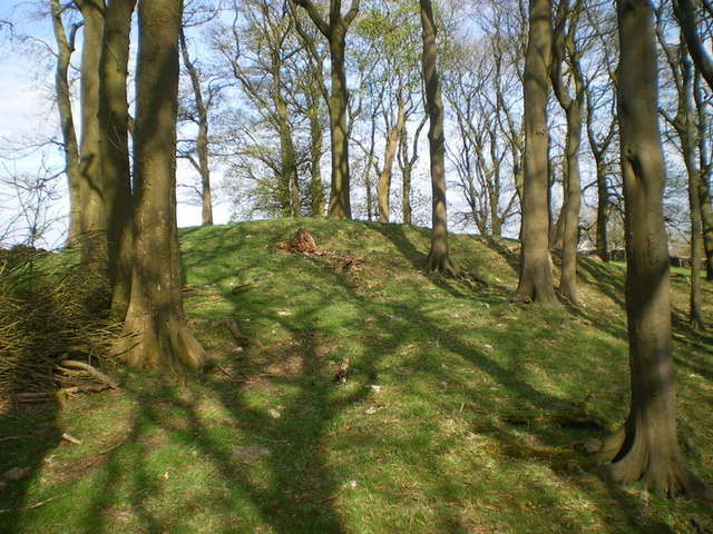
Image: © Richard Law Taken: 27 Apr 2010
A round barrow/tumulus, presumed to be Bronze Age, in the copse at Fairfield Low. According to http://www.megalithic.co.uk/article.php?sid=22684&map=1, there were burial remains found when the site was excavated, but there's little evidence any more.
Images are licensed for reuse under creativecommons.org/licenses/by-sa/2.0
Image Location
Latitude
53.262583
Longitude
-1.884376