
The church of SS Peter and Paul in Wisbech - C17 memorial
Introduction
The photograph on this page of The church of SS Peter and Paul in Wisbech - C17 memorial by Evelyn Simak as part of the Geograph project.
The Geograph project started in 2005 with the aim of publishing, organising and preserving representative images for every square kilometre of Great Britain, Ireland and the Isle of Man.

There are currently over 7.5m images from over 14,400 individuals and you can help contribute to the project by visiting https://www.geograph.org.uk
The church of SS Peter and Paul in Wisbech - C17 memorial
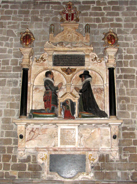
Image: © Evelyn Simak Taken: 22 Apr 2010
The church of SS Peter and Paul > http://www.geograph.org.uk/photo/1828243 is listed amongst the top 100 churches in Simon Jenkins' book "England's 1000 best parish churches". The building was created over a time span covering about 400 years and was built in a variety of styles. At the time the original church was built it was situated right by the seaside by the confluence of the Rivers Nene and Ouse. This first church, however, was a modest Norman building > http://www.geograph.org.uk/photo/1828295 that is now contained within the somewhat confusing present structure. When the church needed to be enlarged in 1250 to make room for more people it was not possible to add on to it on its west side because of the castle that stood there. Additions had to be built onto the other sides of the building, which was completed in the 14th and 15th centuries. Around 1500 the Norman west tower collapsed, damaging part of the remaining Norman structure, and a new tower, detached from the church, was built at its north-west end. The church still houses the original C13 font > http://www.geograph.org.uk/photo/1828346 as well as medieval ceiling bosses and misericords in the sanctuary, and fragments of medieval stained glass > http://www.geograph.org.uk/photo/1828269 in one of its windows. A life-sized brass > http://www.geograph.org.uk/photo/1828341 commemorating Thomas de Braunstone (Constable of Wisbech Castle, d 1401) can be found on the floor and there are a great number of monuments, mainly on the chancel walls, the two perhaps most noteworthy being to Matthias and Jane Taylor (1633) > http://www.geograph.org.uk/photo/1828317 and to Thomas Parke and his wife (1630). A Stuart royal arms > http://www.geograph.org.uk/photo/1828265 dating from the 1660s hangs by the south doorway. During the Victorian restoration the old seating was replaced and most stained windows > http://www.geograph.org.uk/photo/1828299 date from this time or from later.
Images are licensed for reuse under creativecommons.org/licenses/by-sa/2.0
Image Location

Latitude
52.664559
Longitude
0.161898