"The Look-out" Pill Box near Stanbridge
Introduction
The photograph on this page of "The Look-out" Pill Box near Stanbridge by Rob Farrow as part of the Geograph project.
The Geograph project started in 2005 with the aim of publishing, organising and preserving representative images for every square kilometre of Great Britain, Ireland and the Isle of Man.

There are currently over 7.5m images from over 14,400 individuals and you can help contribute to the project by visiting https://www.geograph.org.uk
"The Look-out" Pill Box near Stanbridge
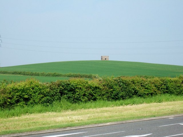
Image: © Rob Farrow Taken: 7 Jun 2006
This little structure is called "The Look-out" and I am assuming that it's a WWII pill box. Cross-checking with the 1:5000 map on http://magic.defra.gov.uk/website/magic/viewer.htm?startTopic=maggb&xygridref=495000,224100&startScale=5000 its map reference is SP9500624157 placing it just six metres inside this gridsquare!
Images are licensed for reuse under creativecommons.org/licenses/by-sa/2.0
Image Location
Latitude
51.907347
Longitude
-0.620445