Railway near Livermead
Introduction
The photograph on this page of Railway near Livermead by Derek Harper as part of the Geograph project.
The Geograph project started in 2005 with the aim of publishing, organising and preserving representative images for every square kilometre of Great Britain, Ireland and the Isle of Man.

There are currently over 7.5m images from over 14,400 individuals and you can help contribute to the project by visiting https://www.geograph.org.uk
Railway near Livermead
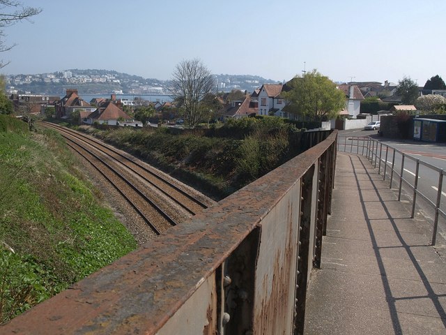
Image: © Derek Harper Taken: 19 Apr 2010
Taken on the railway bridge shown in Image, looking over the metal parapet and into the cutting. Torbay Road bends left to drop down parallel to the railway line through Livermead. Across the bay is Torquay.
Images are licensed for reuse under creativecommons.org/licenses/by-sa/2.0
Image Location
Latitude
50.453192
Longitude
-3.548581