The site of Euxton railway station and the Royal Ordnance Factory
Introduction
The photograph on this page of The site of Euxton railway station and the Royal Ordnance Factory by Martin Stockdale as part of the Geograph project.
The Geograph project started in 2005 with the aim of publishing, organising and preserving representative images for every square kilometre of Great Britain, Ireland and the Isle of Man.

There are currently over 7.5m images from over 14,400 individuals and you can help contribute to the project by visiting https://www.geograph.org.uk
The site of Euxton railway station and the Royal Ordnance Factory
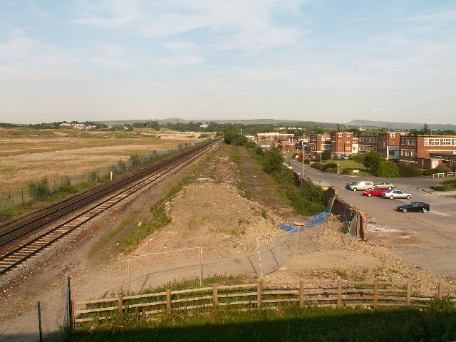
Image: © Martin Stockdale Taken: 7 Jun 2005
In the heyday of the surrounding Royal Ordnance factory, Euxton (pronounced x-ton not youx-ston) station was heavily used by workers travelling to and from work from the surrounding towns of Leyland and Chorley. The Royal Ordnance management offices are still present at the right of the picture and form a business park (now called Xton business park [groan]), the factory covered the whole area to the left of the picture. The station itself has been demolished (centre of the picture), although there is talk about building a new station here.
Images are licensed for reuse under creativecommons.org/licenses/by-sa/2.0
Image Location
Latitude
53.672849
Longitude
-2.66008