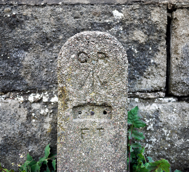
GPO cable marker, Bangor
Introduction
The photograph on this page of GPO cable marker, Bangor by Rossographer as part of the Geograph project.
The Geograph project started in 2005 with the aim of publishing, organising and preserving representative images for every square kilometre of Great Britain, Ireland and the Isle of Man.
There are currently over 7.5m images from over 14,400 individuals and you can help contribute to the project by visiting https://www.geograph.org.uk

Image: © Rossographer Taken: 17 Apr 2010
Old GPO cable marker on the Bryansburn Road in Bangor. This was placed by the General Post Office as a marker plate for their underground Cable network. Originally this would have had a plate giving the distance in feet and inches from post to the underground cable, but this has been removed. Often mistaken as bench marks, the arrow actually signifies that the GPO is a government department. The following information was accessed at http://www.airfieldinformationexchange.org/community/showthread.php?2886-GPO-line-marker-post : "Being a former GPO worker out in the field i can supply the following details. The marker is indeed to indicate that there is a buried joint at the distance specified on the post. Usually the LEAD joint was 'found' in a small coffin approx. 2ft long and usually found at the bottom of a Telegraph pole, before the advent of boxes being constructed. Nowadays, what with H.& S. boxes are provided to prevent footpaths and the like being dug up. In the sticks however, Lead cables usually ran a length of 151-154 yds and these markers were to be found in grass verges but these cables were 'Trunk cables' and somewhat larger (500prs cable as opposed to a 20-50pr cable), as such the 'coffin' was around 5ft in length. An absolute sod to dig out as they were usually quite deep as well. A manhole was provided at certain junctions to work on the larger joints and change-overs." See also Image for a similar but older version of such a marker and also Image for a contemporary version.

