Thoroton Street
Introduction
The photograph on this page of Thoroton Street by John Sutton as part of the Geograph project.
The Geograph project started in 2005 with the aim of publishing, organising and preserving representative images for every square kilometre of Great Britain, Ireland and the Isle of Man.

There are currently over 7.5m images from over 14,400 individuals and you can help contribute to the project by visiting https://www.geograph.org.uk
Thoroton Street
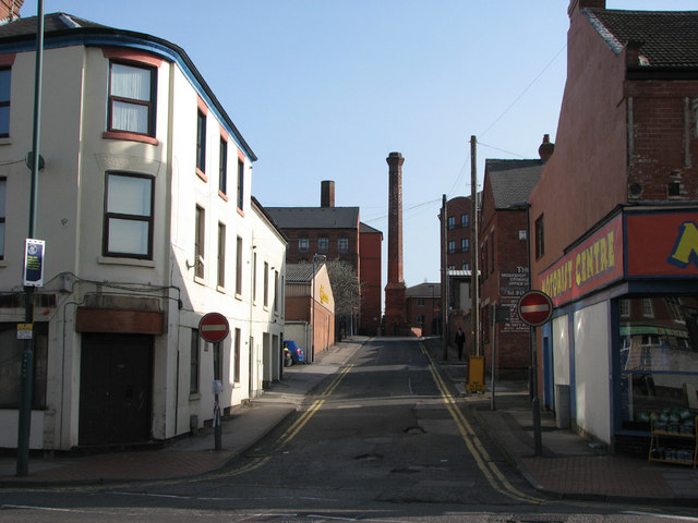
Image: © John Sutton Taken: 16 Apr 2010
Straight ahead is a typical Nottingham hosiery factory, the former Royal Albert Mill on Gamble Street, now student accommodation. Thoroton Street takes its name from the 17th-century Nottinghamshire antiquarian Robert Thoroton - or the Vale of Belvoir village which gave him his surname. The photograph is taken through a gap in the traffic on Alfreton Road.
Images are licensed for reuse under creativecommons.org/licenses/by-sa/2.0
Image Location
Latitude
52.958765
Longitude
-1.166174