Radford Common
Introduction
The photograph on this page of Radford Common by Robin Stott as part of the Geograph project.
The Geograph project started in 2005 with the aim of publishing, organising and preserving representative images for every square kilometre of Great Britain, Ireland and the Isle of Man.

There are currently over 7.5m images from over 14,400 individuals and you can help contribute to the project by visiting https://www.geograph.org.uk
Radford Common
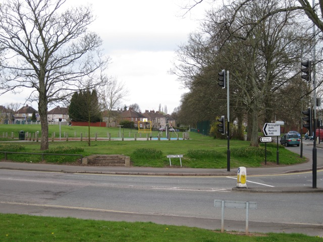
Image: © Robin Stott Taken: 16 Apr 2010
Coventry's commons became public open spaces by Act of Parliament in 1927. This is the southeast corner of a once much more extensive common, seen across Engleton Road at its junction with Radford Road. The level ground nearest the road was the original site of the Radford war memorial Image In the 1980s, because of increasing damage and because the ground could be muddy for the Remembrance ceremony in November, the memorial was moved to a position nearer St Nicholas Church, behind the camera Image
Images are licensed for reuse under creativecommons.org/licenses/by-sa/2.0
Image Location
Latitude
52.423334
Longitude
-1.524976