Bird in Bush Free House, Elsdon
Introduction
The photograph on this page of Bird in Bush Free House, Elsdon by Andrew Curtis as part of the Geograph project.
The Geograph project started in 2005 with the aim of publishing, organising and preserving representative images for every square kilometre of Great Britain, Ireland and the Isle of Man.

There are currently over 7.5m images from over 14,400 individuals and you can help contribute to the project by visiting https://www.geograph.org.uk
Bird in Bush Free House, Elsdon
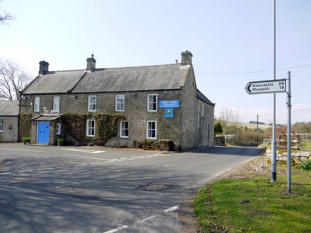
Image: © Andrew Curtis Taken: 16 Apr 2010
Several of Elsdon's C18th-early C19th century buildings, including the Bird in Bush were originally inns, which demonstrates the importance of villages's role at that time as a local transport hub, and the trade brought by Scottish carters and drovers using the developing turnpike network, and the cross-border drove-roads. Northumberland National Park Historic Village Atlas Elsdon: http://www.northumberlandnationalpark.org.uk/understanding/historyarchaeology/historicvillageatlas/elsdonvillageatlas
Images are licensed for reuse under creativecommons.org/licenses/by-sa/2.0
Image Location


Leaflet Map data © OpenStreetMap
Latitude
55.232787
Longitude
-2.102959