'Rosemary' and Hill House, Upper Rosemary Hill
Introduction
The photograph on this page of 'Rosemary' and Hill House, Upper Rosemary Hill by John Brightley as part of the Geograph project.
The Geograph project started in 2005 with the aim of publishing, organising and preserving representative images for every square kilometre of Great Britain, Ireland and the Isle of Man.

There are currently over 7.5m images from over 14,400 individuals and you can help contribute to the project by visiting https://www.geograph.org.uk
'Rosemary' and Hill House, Upper Rosemary Hill
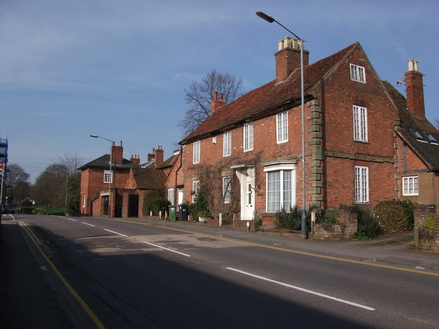
Image: © John Brightley Taken: 10 Apr 2010
'Rosemary', on the right, is a late 17th or early 18th century building according to its listing. http://www.imagesofengland.org.uk/Details/Default.aspx?id=307849&mode=adv Hill House, on the left, is early 19th century. http://www.imagesofengland.org.uk/Details/Default.aspx?id=307847&mode=adv They were both Grade II listed in November 1971.
Images are licensed for reuse under creativecommons.org/licenses/by-sa/2.0
Image Location


Leaflet Map data © OpenStreetMap
Latitude
52.347205
Longitude
-1.577025