Detail of the Board School, Hatherleigh
Introduction
The photograph on this page of Detail of the Board School, Hatherleigh by Humphrey Bolton as part of the Geograph project.
The Geograph project started in 2005 with the aim of publishing, organising and preserving representative images for every square kilometre of Great Britain, Ireland and the Isle of Man.

There are currently over 7.5m images from over 14,400 individuals and you can help contribute to the project by visiting https://www.geograph.org.uk
Detail of the Board School, Hatherleigh
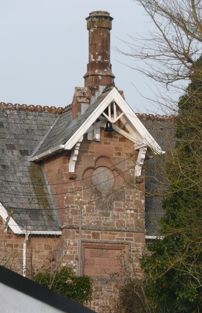
Image: © Humphrey Bolton Taken: 10 Apr 2010
The school is mostly hidden by buildings, and has a long range of buildings in a similar style to this belfry gable, which has an octagonal chimney stack on top, and a datestone inscribed with the year 1875.
Images are licensed for reuse under creativecommons.org/licenses/by-sa/2.0
Image Location
Latitude
50.818914
Longitude
-4.072594