Sand Hall Lodge Cottage
Introduction
The photograph on this page of Sand Hall Lodge Cottage by Mike Kirby as part of the Geograph project.
The Geograph project started in 2005 with the aim of publishing, organising and preserving representative images for every square kilometre of Great Britain, Ireland and the Isle of Man.

There are currently over 7.5m images from over 14,400 individuals and you can help contribute to the project by visiting https://www.geograph.org.uk
Sand Hall Lodge Cottage
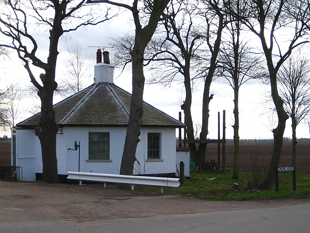
Image: © Mike Kirby Taken: 27 Mar 2010
This Grade II listed gate lodge cottage was erected in the mid 1800’s for John Brunyee of Sand Hall, (No information). Built of stuccoed brick with a Welsh slate roof, it is hexagonal in plan. Shown on the OS map as the round house, it was referred to in the past as “the threepenny bit house” by the locals, because of its shape. It is protected by a length of crash barrier due to the 90 degree turn in the road where the lodge is positioned.
Images are licensed for reuse under creativecommons.org/licenses/by-sa/2.0
Image Location


Leaflet Map data © OpenStreetMap
Latitude
53.594629
Longitude
-0.8514