Bebington Station
Introduction
The photograph on this page of Bebington Station by Tiger as part of the Geograph project.
The Geograph project started in 2005 with the aim of publishing, organising and preserving representative images for every square kilometre of Great Britain, Ireland and the Isle of Man.

There are currently over 7.5m images from over 14,400 individuals and you can help contribute to the project by visiting https://www.geograph.org.uk
Bebington Station
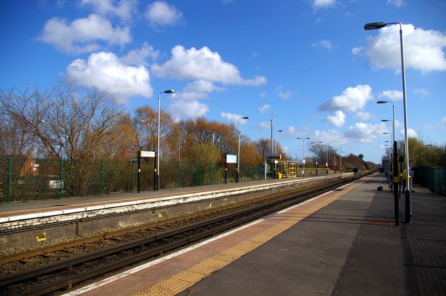
Image: © Tiger Taken: 7 Apr 2010
A view looking towards Chester from the same location as Ben Brooksbank's historic photo http://geograph.org.uk/photo/1775236 nearly 49 years later. The four roads of the Birkenhead Joint Railway's main line have been reduced to two for Merseyrail's Wirral line from Liverpool to Chester and Ellesmere Port. The site of the eastern platform and pair of tracks (beyond the green wire fence) is now devoted to car parking. The substantial brick buildings and platform awnings have been replaced by simple structures like bus shelters, and the chocolate and cream Western Region name signs have given way to slim contemporary ones.
Images are licensed for reuse under creativecommons.org/licenses/by-sa/2.0
Image Location
Latitude
53.356754
Longitude
-3.003614