Square house Tal-y-bont
Introduction
The photograph on this page of Square house Tal-y-bont by Chris Denny as part of the Geograph project.
The Geograph project started in 2005 with the aim of publishing, organising and preserving representative images for every square kilometre of Great Britain, Ireland and the Isle of Man.

There are currently over 7.5m images from over 14,400 individuals and you can help contribute to the project by visiting https://www.geograph.org.uk
Square house Tal-y-bont
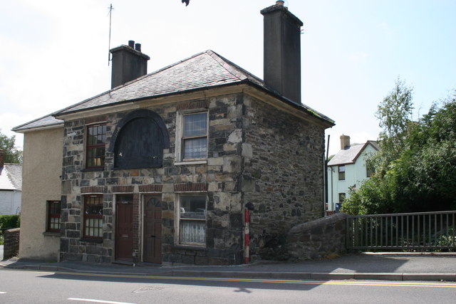
Image: © Chris Denny Taken: 7 Jun 2008
Actually it isn't square as the bit on the extreme left is an extension. I am puzzled as to what it was. The black boarding above the doors looks rather like a toll house board. And what was the red and white pole at the side by the bridge over the Afon Ceulan?
Images are licensed for reuse under creativecommons.org/licenses/by-sa/2.0
Image Location
Latitude
52.484174
Longitude
-3.982698