Penmere Platform
Introduction
The photograph on this page of Penmere Platform by Stephen McKay as part of the Geograph project.
The Geograph project started in 2005 with the aim of publishing, organising and preserving representative images for every square kilometre of Great Britain, Ireland and the Isle of Man.

There are currently over 7.5m images from over 14,400 individuals and you can help contribute to the project by visiting https://www.geograph.org.uk
Penmere Platform
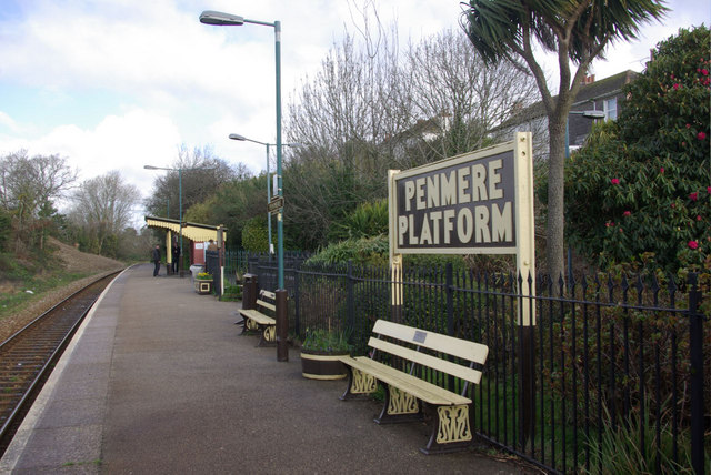
Image: © Stephen McKay Taken: 31 Mar 2010
This halt on the Truro - Falmouth branch line is one of a number of Cornish stations to be given 1950s-style British Transport Commission signs, and a 'running-in' board to an even older Great Western Railway design. Even the 'Platform' name - used by the GWR at some of its smaller stations - has been revived. All of this and the immaculate presentation of the station is facilitated by an active 'Friends of Penmere' group. The halt was opened in 1925 - some 62 years after the railway itself - to serve the growing western suburbs of Falmouth.
Images are licensed for reuse under creativecommons.org/licenses/by-sa/2.0
Image Location
Latitude
50.150593
Longitude
-5.083419