Derelict buildings on Woodstock Road
Introduction
The photograph on this page of Derelict buildings on Woodstock Road by Thomas Nugent as part of the Geograph project.
The Geograph project started in 2005 with the aim of publishing, organising and preserving representative images for every square kilometre of Great Britain, Ireland and the Isle of Man.

There are currently over 7.5m images from over 14,400 individuals and you can help contribute to the project by visiting https://www.geograph.org.uk
Derelict buildings on Woodstock Road
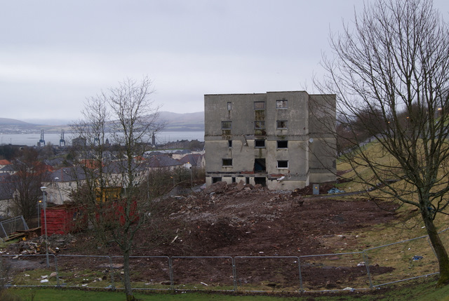
Image: © Thomas Nugent Taken: 29 Mar 2010
Flat roofs and a steep north facing slope in one of the wettest towns in the UK combined to make these flats damp ridden almost from the day that the first tenants moved in in the late 1960s. Take a look at the view of the Firth of Clyde and the southern Highlands that was on offer from the north facing windows.
Images are licensed for reuse under creativecommons.org/licenses/by-sa/2.0
Image Location


Leaflet Map data © OpenStreetMap
Latitude
55.938104
Longitude
-4.782549