Rugglestone Rock
Introduction
The photograph on this page of Rugglestone Rock by Guy Wareham as part of the Geograph project.
The Geograph project started in 2005 with the aim of publishing, organising and preserving representative images for every square kilometre of Great Britain, Ireland and the Isle of Man.

There are currently over 7.5m images from over 14,400 individuals and you can help contribute to the project by visiting https://www.geograph.org.uk
Rugglestone Rock
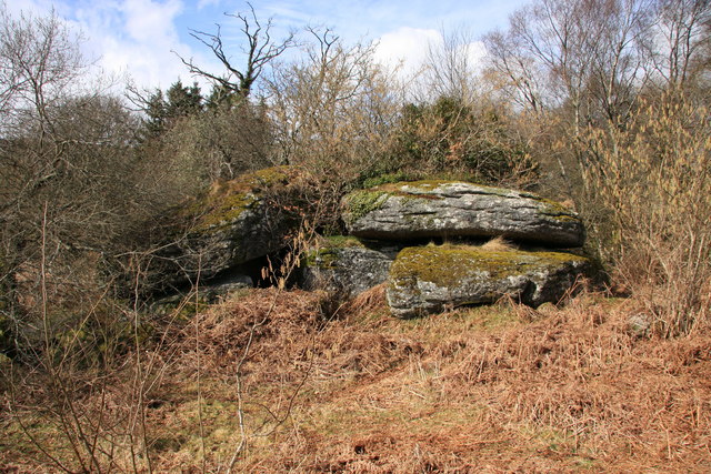
Image: © Guy Wareham Taken: 31 Mar 2010
The logan stone marked on the OS 1:25000 map probably refers to the very large rock on the left which rests on the rock beneath it at only two points but it is hard to imagine it ever rocking.
Images are licensed for reuse under creativecommons.org/licenses/by-sa/2.0
Image Location
Latitude
50.573628
Longitude
-3.803915