Civic Centre, High Street, Uxbridge
Introduction
The photograph on this page of Civic Centre, High Street, Uxbridge by Brian Robert Marshall as part of the Geograph project.
The Geograph project started in 2005 with the aim of publishing, organising and preserving representative images for every square kilometre of Great Britain, Ireland and the Isle of Man.

There are currently over 7.5m images from over 14,400 individuals and you can help contribute to the project by visiting https://www.geograph.org.uk
Civic Centre, High Street, Uxbridge
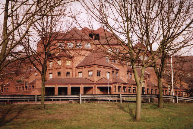
Image: © Brian Robert Marshall Taken: 28 Mar 2003
This shows the staff entrance to the Civic Centre offices, home to the London Borough of Hillingdon. LBH came into being in 1965 when local government in London was re-organised. Originally this was Middlesex. To my mind it is only in London by dint of administrative convenience. Uxbridge doesn't have a London postcode or a London telephone number prefix. Parts of it feel much more like the neighbouring counties of Buckinghamshire and Hertfordshire.
Images are licensed for reuse under creativecommons.org/licenses/by-sa/2.0
Image Location
Latitude
51.543031
Longitude
-0.477331