Former Tower Pit
Introduction
The photograph on this page of Former Tower Pit by Alan Murray-Rust as part of the Geograph project.
The Geograph project started in 2005 with the aim of publishing, organising and preserving representative images for every square kilometre of Great Britain, Ireland and the Isle of Man.

There are currently over 7.5m images from over 14,400 individuals and you can help contribute to the project by visiting https://www.geograph.org.uk
Former Tower Pit
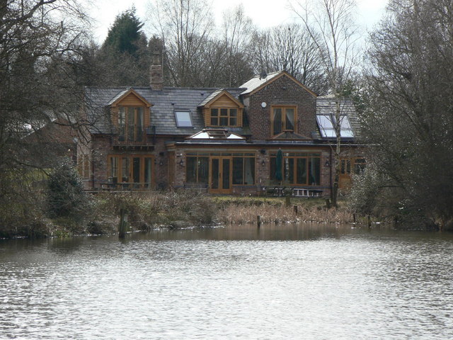
Image: © Alan Murray-Rust Taken: 25 Mar 2010
The taller part of the building is the former winding engine house of the failed Tower Pit of 1846 http://www.geograph.org.uk/photo/1778705 . It now forms just small part of a much larger modern house. The pond is the former ice pond http://www.geograph.org.uk/photo/1778717 of the now demolished Poynton Towers mansion.
Images are licensed for reuse under creativecommons.org/licenses/by-sa/2.0
Image Location
Latitude
53.354185
Longitude
-2.10753