Gravestone pathway, Ballast Hills
Introduction
The photograph on this page of Gravestone pathway, Ballast Hills by Andrew Curtis as part of the Geograph project.
The Geograph project started in 2005 with the aim of publishing, organising and preserving representative images for every square kilometre of Great Britain, Ireland and the Isle of Man.

There are currently over 7.5m images from over 14,400 individuals and you can help contribute to the project by visiting https://www.geograph.org.uk
Gravestone pathway, Ballast Hills
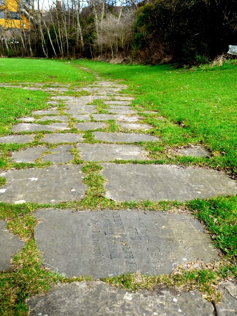
Image: © Andrew Curtis Taken: 28 Mar 2010
Ballast Hills was once a notable landmark created with the dumped ballast of returning colliers. The site later become an important non-conformist burial-ground from C17th until its closure in 1853. Today, the area is a park Image, with some paths created using the graveyard headstones. Tyne and Wear HER (1597): Ouseburn, Ballast Hills Graveyard http://www.twsitelines.info
Images are licensed for reuse under creativecommons.org/licenses/by-sa/2.0
Image Location
Latitude
54.972254
Longitude
-1.586781