The Henge
Introduction
The photograph on this page of The Henge by Andrew Wood as part of the Geograph project.
The Geograph project started in 2005 with the aim of publishing, organising and preserving representative images for every square kilometre of Great Britain, Ireland and the Isle of Man.

There are currently over 7.5m images from over 14,400 individuals and you can help contribute to the project by visiting https://www.geograph.org.uk
The Henge
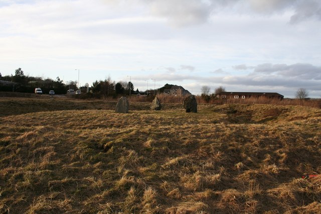
Image: © Andrew Wood Taken: 19 Mar 2010
The Henge at Broomend of Crichie with the ease of access illustrated. The gate to the field is top left , the access road behind that and far top left is a glimpse of the landmark filling station.
Images are licensed for reuse under creativecommons.org/licenses/by-sa/2.0
Image Location
Latitude
57.267149
Longitude
-2.367894