The No Place Inn, Plymouth
Introduction
The photograph on this page of The No Place Inn, Plymouth by Derek Harper as part of the Geograph project.
The Geograph project started in 2005 with the aim of publishing, organising and preserving representative images for every square kilometre of Great Britain, Ireland and the Isle of Man.

There are currently over 7.5m images from over 14,400 individuals and you can help contribute to the project by visiting https://www.geograph.org.uk
The No Place Inn, Plymouth
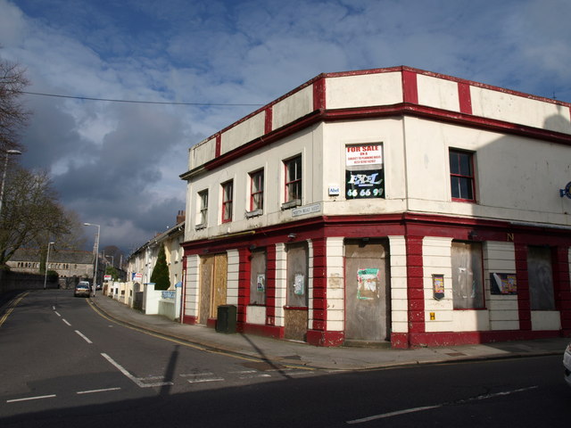
Image: © Derek Harper Taken: 27 Mar 2010
This C19 pub, now closed, on the corner of North Road West and Stoke Road, has been recommended for listing http://www.plymouth.gov.uk/ms20c_characterisation_study_appendix.pdf . As I was taking this photo, I was aware that a car coming from the right along Stoke Road was slowing to turn right into North Road West, and was surprised that it wasn't visible in my viewfinder - in fact you can see a fragment of it - as no traffic was coming the other way. However, I was thoroughly amazed to realise, a moment after releasing the shutter, that it was a police car delaying its manoeuvre in order for me to take the photo! (Though my wife ungenerously suggests that they were pausing to record my details.)
Images are licensed for reuse under creativecommons.org/licenses/by-sa/2.0
Image Location


Leaflet Map data © OpenStreetMap
Latitude
50.37336
Longitude
-4.156199