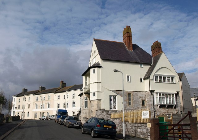
All Saints Vicarage, Plymouth
Introduction
The photograph on this page of All Saints Vicarage, Plymouth by Derek Harper as part of the Geograph project.
The Geograph project started in 2005 with the aim of publishing, organising and preserving representative images for every square kilometre of Great Britain, Ireland and the Isle of Man.
There are currently over 7.5m images from over 14,400 individuals and you can help contribute to the project by visiting https://www.geograph.org.uk

Image: © Derek Harper Taken: 27 Mar 2010
Intriguing to compare this view of the Arts and Crafts building, dating from 1887 and by J D Sedding, with the image at http://www.imagesofengland.org.uk/Details/Default.aspx?id=473497&mode=adv , taken in 2002, some while after what Cherry & Pevsner (who refer to it as a "clergy house") called "unpromising repairs in progress, 1991". As the listed building description points out, it is on an "irregular corner site plan with various projections designed to give interest from any viewpoint". The area has now been smartly renovated in line with a 2004 planning and design brief - see http://www.rudi.net/system/files/file/required_file/Plymouth+Harwell+Street+Design+Brief.pdf .

