Owen Road, Penn Fields, Wolverhampton
Introduction
The photograph on this page of Owen Road, Penn Fields, Wolverhampton by Roger D Kidd as part of the Geograph project.
The Geograph project started in 2005 with the aim of publishing, organising and preserving representative images for every square kilometre of Great Britain, Ireland and the Isle of Man.

There are currently over 7.5m images from over 14,400 individuals and you can help contribute to the project by visiting https://www.geograph.org.uk
Owen Road, Penn Fields, Wolverhampton
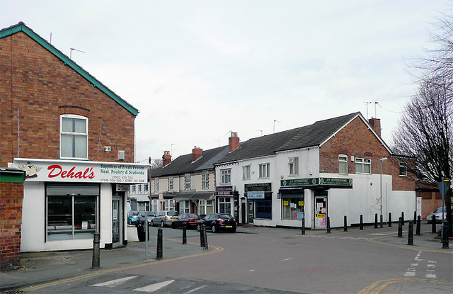
Image: © Roger D Kidd Taken: 17 Mar 2010
At this junction Owen Road passes Lime Street (ahead to the right past the white-painted wall) and Rayleigh Road behind the camera. The area contains mainly early 20th or late Victorian terraced housing. The community is racially very mixed. Many corner shops still thrive, and other premises also support a variety of small businesses. In this image, on the left is a trader in fresh or frozen meat, poultry and sea food. On the corner of Lime Street opposite is a corner grocer store, oops, I mean Superstore and off licence. In Owen road is a catering business and a hair/beauty/massage specialist, which I haven't tried yet ;-)
Images are licensed for reuse under creativecommons.org/licenses/by-sa/2.0
Image Location
Latitude
52.578359
Longitude
-2.143616