Church House and The Friars, Christchurch
Introduction
The photograph on this page of Church House and The Friars, Christchurch by Jaggery as part of the Geograph project.
The Geograph project started in 2005 with the aim of publishing, organising and preserving representative images for every square kilometre of Great Britain, Ireland and the Isle of Man.

There are currently over 7.5m images from over 14,400 individuals and you can help contribute to the project by visiting https://www.geograph.org.uk
Church House and The Friars, Christchurch
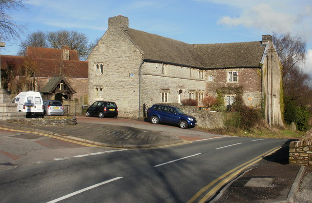
Image: © Jaggery Taken: 21 Feb 2010
Grade II listed building of rubble stone in the centre of Christchurch, located next to the church. http://www.geograph.org.uk/photo/1726658 The original building probably appeared in the late medieval period. It was considerably enlarged in the 16th century. The external appearance of the building is much as it would have looked in 1600. The datable features are of that period, or reproductions of that period. It was one house in 1980 but is now two private dwellings, 1 and 2 Cats Ash Road. The black car is parked in front of Church House ; The Friars is at right angles to Church House.
Images are licensed for reuse under creativecommons.org/licenses/by-sa/2.0
Image Location
Latitude
51.598729
Longitude
-2.945609