Flamborough Castle
Introduction
The photograph on this page of Flamborough Castle by Alan Walker as part of the Geograph project.
The Geograph project started in 2005 with the aim of publishing, organising and preserving representative images for every square kilometre of Great Britain, Ireland and the Isle of Man.

There are currently over 7.5m images from over 14,400 individuals and you can help contribute to the project by visiting https://www.geograph.org.uk
Flamborough Castle
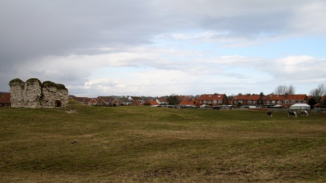
Image: © Alan Walker Taken: 14 Mar 2010
The photograph shows the tower, being the only remains above ground, and associated earthworks. This 'castle' was, in fact, the fortified manor house of the Constable family who had received licence to crenelate in 1351. Although containing a tower, a hall, a great parlour, a lord’s parlour, a chapel, a court house, a mill house, and a great barn it was described in the early 16th century as being taken for a manor house rather than a castle. It can be compared with the Northumbrian ‘Pele’ towers and, like them, was probably made defensible to guard against Scottish raiders. The above paragraph was adapted from an East Riding Council leaflet that is available online: http://www.eastriding.gov.uk/EasySiteWeb/GatewayLink.aspx?alId=2256 . Click here for another photograph of the castle: http://www.geograph.org.uk/photo/1772032 . For a photograph showing the tower, click here: http://www.geograph.org.uk/photo/1772013 . - - - For other photographs of the castle see the following by: Paul Allison: Image, Paul Glazzard: Image and J Thomas: Image
Images are licensed for reuse under creativecommons.org/licenses/by-sa/2.0
Image Location


Leaflet Map data © OpenStreetMap
Latitude
54.114684
Longitude
-0.125793