Tower on the Arthurstone estate
Introduction
The photograph on this page of Tower on the Arthurstone estate by Oliver Dixon as part of the Geograph project.
The Geograph project started in 2005 with the aim of publishing, organising and preserving representative images for every square kilometre of Great Britain, Ireland and the Isle of Man.

There are currently over 7.5m images from over 14,400 individuals and you can help contribute to the project by visiting https://www.geograph.org.uk
Tower on the Arthurstone estate
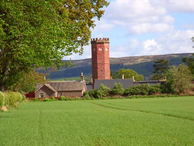
Image: © Oliver Dixon Taken: 24 May 2006
Just off the A94 Coupar Angus to Forfar road; Sidlaw Hills in the distance. The four storey central tower, octagonal with crenellated top and bullseye windows, is a folly built in 1800.
Images are licensed for reuse under creativecommons.org/licenses/by-sa/2.0
Image Location
Latitude
56.573118
Longitude
-3.202744