Bradmore Church
Introduction
The photograph on this page of Bradmore Church by Alan Murray-Rust as part of the Geograph project.
The Geograph project started in 2005 with the aim of publishing, organising and preserving representative images for every square kilometre of Great Britain, Ireland and the Isle of Man.

There are currently over 7.5m images from over 14,400 individuals and you can help contribute to the project by visiting https://www.geograph.org.uk
Bradmore Church
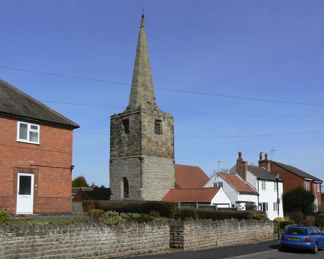
Image: © Alan Murray-Rust Taken: 23 Mar 2010
What can be seen here is basically all that survived the fire of 1705. The church was not rebuilt at that time, but a new nave - described by English Heritage as a "late C19 mission church" was added in the 19th century, filling all the available space between the surrounding properties. Unusually for medieval church building, it only has Grade II Listing.
Images are licensed for reuse under creativecommons.org/licenses/by-sa/2.0
Image Location
Latitude
52.874751
Longitude
-1.13391