Looking east towards Leigh Bridge, 1976
Introduction
The photograph on this page of Looking east towards Leigh Bridge, 1976 by Chris Denny as part of the Geograph project.
The Geograph project started in 2005 with the aim of publishing, organising and preserving representative images for every square kilometre of Great Britain, Ireland and the Isle of Man.

There are currently over 7.5m images from over 14,400 individuals and you can help contribute to the project by visiting https://www.geograph.org.uk
Looking east towards Leigh Bridge, 1976
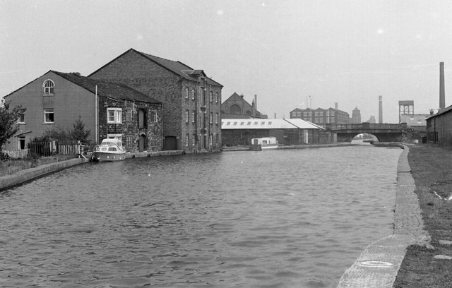
Image: © Chris Denny Taken: Unknown
Leigh Bridge is where the Bridgewater Canal (to the east) becomes the Leigh Branch of the Leeds and Liverpool Canal (seen here). The large building to the left has become the Waterside Inn. Just visible on the extreme right is the long building of Manley's Rope works.
Images are licensed for reuse under creativecommons.org/licenses/by-sa/2.0
Image Location
Latitude
53.493946
Longitude
-2.521187