Mather Lane Bridge 1976
Introduction
The photograph on this page of Mather Lane Bridge 1976 by Chris Denny as part of the Geograph project.
The Geograph project started in 2005 with the aim of publishing, organising and preserving representative images for every square kilometre of Great Britain, Ireland and the Isle of Man.

There are currently over 7.5m images from over 14,400 individuals and you can help contribute to the project by visiting https://www.geograph.org.uk
Mather Lane Bridge 1976
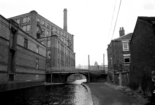
Image: © Chris Denny Taken: Unknown
Mather Lane Mill, just beyond the bridge, is still standing, as is the building on the far left, though it is empty. The building immediately to the right of the bridge was, once upon a time, the Navigation Inn. The site is now occupied by low rise flats.
Images are licensed for reuse under creativecommons.org/licenses/by-sa/2.0
Image Location
Latitude
53.492828
Longitude
-2.509567