Butts Basin, 1976
Introduction
The photograph on this page of Butts Basin, 1976 by Chris Denny as part of the Geograph project.
The Geograph project started in 2005 with the aim of publishing, organising and preserving representative images for every square kilometre of Great Britain, Ireland and the Isle of Man.

There are currently over 7.5m images from over 14,400 individuals and you can help contribute to the project by visiting https://www.geograph.org.uk
Butts Basin, 1976
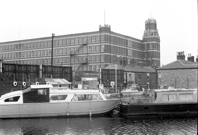
Image: © Chris Denny Taken: Unknown
Although the basin itself has changed little in the past 30 odd years the dominating bulk of Alder Mill, then operated by Courtauld Viyella, has long since vanished.
Images are licensed for reuse under creativecommons.org/licenses/by-sa/2.0
Image Location
Latitude
53.49225
Longitude
-2.497351