Venterdon Methodist Chapel
Introduction
The photograph on this page of Venterdon Methodist Chapel by Rod Allday as part of the Geograph project.
The Geograph project started in 2005 with the aim of publishing, organising and preserving representative images for every square kilometre of Great Britain, Ireland and the Isle of Man.

There are currently over 7.5m images from over 14,400 individuals and you can help contribute to the project by visiting https://www.geograph.org.uk
Venterdon Methodist Chapel
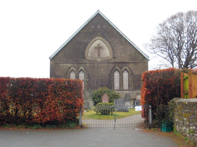
Image: © Rod Allday Taken: 20 Mar 2010
The original Wesleyan chapel in Venterdon was erected in 1816 and this new chapel was built behind it in 1869. The old building was converted to a Sunday school but has since been demolished. It's interesting to compare this photo with Tony Atkin's Image, taken from almost exactly the same position but about six weeks later in the year.
Images are licensed for reuse under creativecommons.org/licenses/by-sa/2.0
Image Location
Latitude
50.550804
Longitude
-4.320561