Helions Bumpstead
Introduction
The photograph on this page of Helions Bumpstead by Tiger as part of the Geograph project.
The Geograph project started in 2005 with the aim of publishing, organising and preserving representative images for every square kilometre of Great Britain, Ireland and the Isle of Man.

There are currently over 7.5m images from over 14,400 individuals and you can help contribute to the project by visiting https://www.geograph.org.uk
Helions Bumpstead
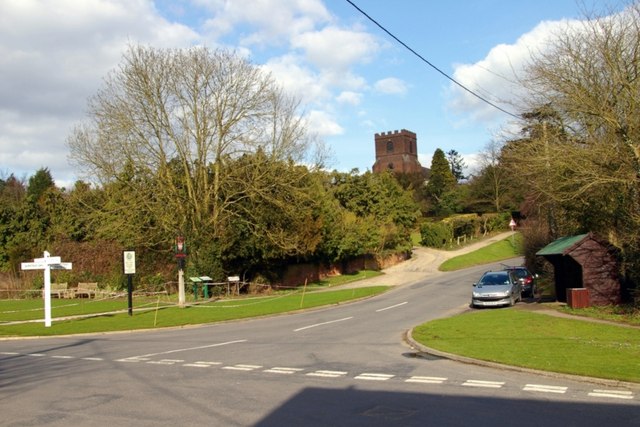
Image: © Tiger Taken: 21 Mar 2010
Looking towards St Andrew's Church from the crossroads in the village centre, nearly fifty years on from Ben Brooksbank's photo of the same view http://www.geograph.org.uk/photo/1744122 The changes are few and relatively subtle. An array of signs has appeared on the opposite corner: a traditional-style fingerpost, a decorative village sign http://www.geograph.org.uk/photo/1763961 a plaque celebrating a Best-kept Village award and a plan of public footpaths in the parish. On the right a bus shelter and litter bin have appeared and the cars parked in the lay-by are no longer British marques! The telephone cables have been laid underground but the power lines are still overhead. The elaborate contraption on top of the church tower has gone. And of course the pre-Worboys "bend" sign in Church Hill has given way to the modern standard. For a similar view eleven years later see Glyn Baker's Image
Images are licensed for reuse under creativecommons.org/licenses/by-sa/2.0
Image Location
Latitude
52.048202
Longitude
0.406209