Great Notley, Rayne and Braintree from the air
Introduction
The photograph on this page of Great Notley, Rayne and Braintree from the air by Thomas Nugent as part of the Geograph project.
The Geograph project started in 2005 with the aim of publishing, organising and preserving representative images for every square kilometre of Great Britain, Ireland and the Isle of Man.

There are currently over 7.5m images from over 14,400 individuals and you can help contribute to the project by visiting https://www.geograph.org.uk
Great Notley, Rayne and Braintree from the air
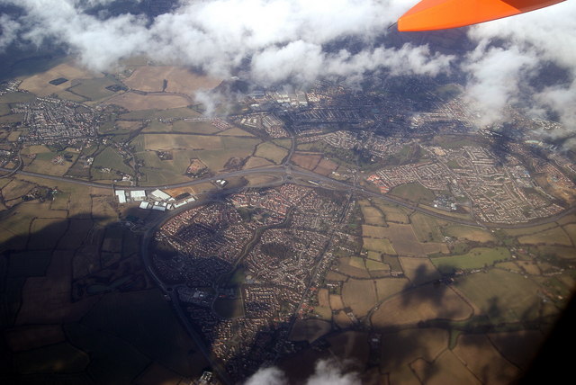
Image: © Thomas Nugent Taken: 15 Mar 2010
Great Notley is at the bottom of the photo, Rayne is top left and Braintree is top right. The A120 road runs horizontally through the centre and is joined from the A131 at the large junction in the centre of the photo. Viewed from a Prague bound plane which has just taken off from Stansted Airport.
Images are licensed for reuse under creativecommons.org/licenses/by-sa/2.0
Image Location
Latitude
51.855806
Longitude
0.532441