Barnstaple (Victoria Road) Station
Introduction
The photograph on this page of Barnstaple (Victoria Road) Station by Ben Brooksbank as part of the Geograph project.
The Geograph project started in 2005 with the aim of publishing, organising and preserving representative images for every square kilometre of Great Britain, Ireland and the Isle of Man.

There are currently over 7.5m images from over 14,400 individuals and you can help contribute to the project by visiting https://www.geograph.org.uk
Barnstaple (Victoria Road) Station
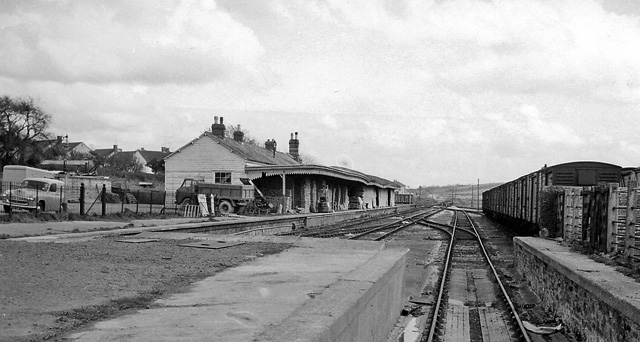
Image: © Ben Brooksbank Taken: 17 Apr 1964
View eastward, towards Taunton, from buffer-stops of disused terminus of former GWR line from Taunton, which also connected with the SR line at Barnstaple Junction until the line was closed entirely on 3/10/66. Meanwhile this station had been closed to passengers on 13/6/60 but to Goods (from Barnstaple Junction) not until 5/3/70.
Images are licensed for reuse under creativecommons.org/licenses/by-sa/2.0
Image Location
Latitude
51.075667
Longitude
-4.047789