The Height of the Spate
Introduction
The photograph on this page of The Height of the Spate by Anne Burgess as part of the Geograph project.
The Geograph project started in 2005 with the aim of publishing, organising and preserving representative images for every square kilometre of Great Britain, Ireland and the Isle of Man.

There are currently over 7.5m images from over 14,400 individuals and you can help contribute to the project by visiting https://www.geograph.org.uk
The Height of the Spate
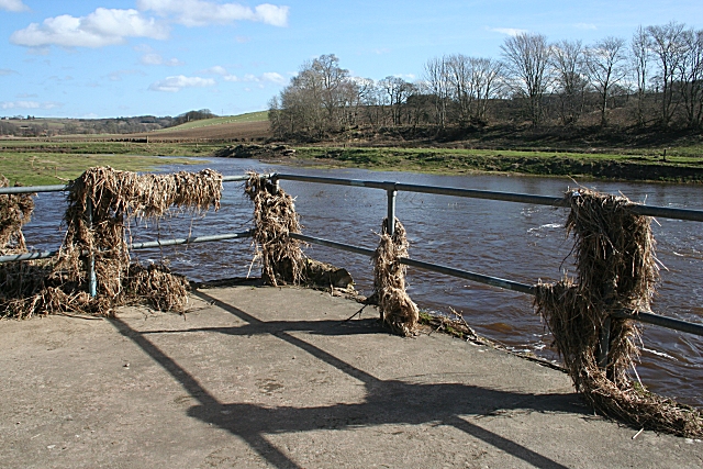
Image: © Anne Burgess Taken: 19 Mar 2010
This is the platform from which Image] descends to river level. I estimate that the railings here are a good five metres above the present, still high, water level, and they are festooned with debris which was presumably washed down by the recent spate.
Images are licensed for reuse under creativecommons.org/licenses/by-sa/2.0
Image Location
Latitude
57.637343
Longitude
-2.538114