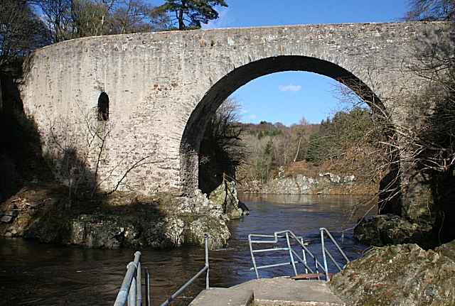
Bridge of Alvah
Introduction
The photograph on this page of Bridge of Alvah by Anne Burgess as part of the Geograph project.
The Geograph project started in 2005 with the aim of publishing, organising and preserving representative images for every square kilometre of Great Britain, Ireland and the Isle of Man.
There are currently over 7.5m images from over 14,400 individuals and you can help contribute to the project by visiting https://www.geograph.org.uk

Image: © Anne Burgess Taken: 19 Mar 2010
Because of the curve in the river, it is difficult to get a good view of the bridge from the right bank. It was built in 1771-3 for the Duke of Fife and incorporates a room for the toll collector within the structure. See http://canmore.rcahms.gov.uk/en/site/110833/details/bridge+of+alvah/ and http://hsewsf.sedsh.gov.uk/hslive/hsstart?P_HBNUM=2883 which are not entirely consistent with one another! The broken railings in the foreground are part of a walkway along the bank. I am not sure whether they have been in that state for a while, or whether they were damaged by this year's spate.

