Colne: Western end of Greenfield Road
Introduction
The photograph on this page of Colne: Western end of Greenfield Road by Dr Neil Clifton as part of the Geograph project.
The Geograph project started in 2005 with the aim of publishing, organising and preserving representative images for every square kilometre of Great Britain, Ireland and the Isle of Man.

There are currently over 7.5m images from over 14,400 individuals and you can help contribute to the project by visiting https://www.geograph.org.uk
Colne: Western end of Greenfield Road
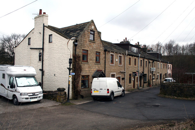
Image: © Dr Neil Clifton Taken: 17 Mar 2010
At its western end, Greenfield Road turns through a right angle to the north, so that this group of houses are perpendicular to the main run of the road. The numbering of these houses appears idiosyncratic, but can be explained in terms of their history. When first built, this was a block of sixteen back-to-back houses in eight pairs. The front houses, seen here, were numbered consecutively 102 to 109. The numbering was then continued round the back, so that the houses at the rear had numbers 110 (far end) to 117. Over the years, all except three of the back-to-back pairs were knocked through to make single houses, which took the number of the front house, in the cases of 103, 104, 105 and 109. Thus numbers 116, 115, 114 and 110 went out of use. In the case of the nearest pair of houses, however, when knocked through into a single house, it took the number of the back house, 117. So now we have at the front houses numbered 117, then 103 to 109, of which three, (106, 107, and 108) are still back-to-backs. And round the back, we have just three back-to-backs, Nos 111, 112 and 113.
Images are licensed for reuse under creativecommons.org/licenses/by-sa/2.0
Image Location
Latitude
53.852467
Longitude
-2.199103