Whitehead from the Bla Hole (2)
Introduction
The photograph on this page of Whitehead from the Bla Hole (2) by Albert Bridge as part of the Geograph project.
The Geograph project started in 2005 with the aim of publishing, organising and preserving representative images for every square kilometre of Great Britain, Ireland and the Isle of Man.

There are currently over 7.5m images from over 14,400 individuals and you can help contribute to the project by visiting https://www.geograph.org.uk
Whitehead from the Bla Hole (2)
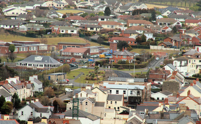
Image: © Albert Bridge Taken: 17 Mar 2010
See Image Today’s view, north, from the Bla Hole Image The Islandmagee Road is about the middle of the photo with the bowling green at middle left. The fire station Image training tower is the green object (middle bottom) and Castle Chester is the stone structure at bottom right.
Images are licensed for reuse under creativecommons.org/licenses/by-sa/2.0
Image Location
Latitude
54.757452
Longitude
-5.711237