London Nautical School
Introduction
The photograph on this page of London Nautical School by Derek Harper as part of the Geograph project.
The Geograph project started in 2005 with the aim of publishing, organising and preserving representative images for every square kilometre of Great Britain, Ireland and the Isle of Man.

There are currently over 7.5m images from over 14,400 individuals and you can help contribute to the project by visiting https://www.geograph.org.uk
London Nautical School
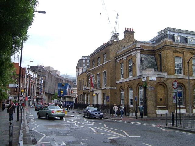
Image: © Derek Harper Taken: 19 May 2006
Stamford Street looking east, with the London Nautical School on the right on the corner of Duchy Street. It moved here in 1965, occupying premises originally built in the 1820s as an orphanage and a chapel http://www.lns.org.uk/historical.htm .
Images are licensed for reuse under creativecommons.org/licenses/by-sa/2.0
Image Location
Latitude
51.506642
Longitude
-0.108648