Chesterfield Canal and Trans Pennine Trail
Introduction
The photograph on this page of Chesterfield Canal and Trans Pennine Trail by David Morris as part of the Geograph project.
The Geograph project started in 2005 with the aim of publishing, organising and preserving representative images for every square kilometre of Great Britain, Ireland and the Isle of Man.

There are currently over 7.5m images from over 14,400 individuals and you can help contribute to the project by visiting https://www.geograph.org.uk
Chesterfield Canal and Trans Pennine Trail
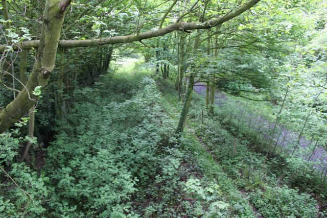
Image: © David Morris Taken: 27 May 2006
Picture Image] looks towards the bridge I'm stood on here. From here, you can clearly see the cut of the disused Chesterfield Canal and, to the right, the path of the old GC (MS&LR) railway between Killamarsh and Renishaw. Planning permission has recently been posted (mid 2006) to try to rewater the canal almost up to this point from Renishaw. Up ahead, the canal turns to the south-west, and when built, didn't go under the bridge, but continued on a north-east line following the contour of the hill. It was diverted when the railway was built. Ironic really that the canal may yet end up back in full working condition whereas the railway will now be nothing more than a cycle and leisure trail.
Images are licensed for reuse under creativecommons.org/licenses/by-sa/2.0
Image Location
Latitude
53.302479
Longitude
-1.332213