The King Building, Belfast (detail)
Introduction
The photograph on this page of The King Building, Belfast (detail) by Albert Bridge as part of the Geograph project.
The Geograph project started in 2005 with the aim of publishing, organising and preserving representative images for every square kilometre of Great Britain, Ireland and the Isle of Man.

There are currently over 7.5m images from over 14,400 individuals and you can help contribute to the project by visiting https://www.geograph.org.uk
The King Building, Belfast (detail)
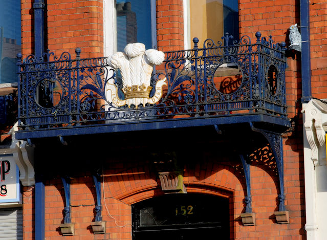
Image: © Albert Bridge Taken: 14 Mar 2010
Balcony ironwork on the King Building (formerly the Musgrave Foundry, Mountpottinger Works) on the Albertbridge Road.
Images are licensed for reuse under creativecommons.org/licenses/by-sa/2.0
Image Location
Latitude
54.595411
Longitude
-5.902626