St Giles Tower
Introduction
The photograph on this page of St Giles Tower by Malc McDonald as part of the Geograph project.
The Geograph project started in 2005 with the aim of publishing, organising and preserving representative images for every square kilometre of Great Britain, Ireland and the Isle of Man.

There are currently over 7.5m images from over 14,400 individuals and you can help contribute to the project by visiting https://www.geograph.org.uk
St Giles Tower
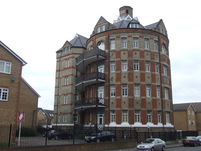
Image: © Malc McDonald Taken: 13 Mar 2010
Much of the former St Giles Hospital has been demolished and replaced by new housing/ The circular ward block of the old hospital survives, now converted into flats. View from Havil Street.
Images are licensed for reuse under creativecommons.org/licenses/by-sa/2.0
Image Location
Latitude
51.475658
Longitude
-0.083433