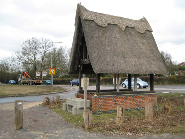
Epping Forest: Honey Lane shelter
Introduction
The photograph on this page of Epping Forest: Honey Lane shelter by Nigel Cox as part of the Geograph project.
The Geograph project started in 2005 with the aim of publishing, organising and preserving representative images for every square kilometre of Great Britain, Ireland and the Isle of Man.
There are currently over 7.5m images from over 14,400 individuals and you can help contribute to the project by visiting https://www.geograph.org.uk

Image: © Nigel Cox Taken: 3 Mar 2010
All the old Ordnance Survey maps available on line, from 1872 onwards, describe a "Rest House and Water Tank" in this location, on the south side of Honey Lane between the Woodbine and Volunteer public houses. The thatched shelter and its drinking trough are locally listed by Epping Forest District Council as being of architectural or historical merit. Robert photographed this from a different angle in Image

