Braithwaite from above
Introduction
The photograph on this page of Braithwaite from above by Jim Barton as part of the Geograph project.
The Geograph project started in 2005 with the aim of publishing, organising and preserving representative images for every square kilometre of Great Britain, Ireland and the Isle of Man.

There are currently over 7.5m images from over 14,400 individuals and you can help contribute to the project by visiting https://www.geograph.org.uk
Braithwaite from above
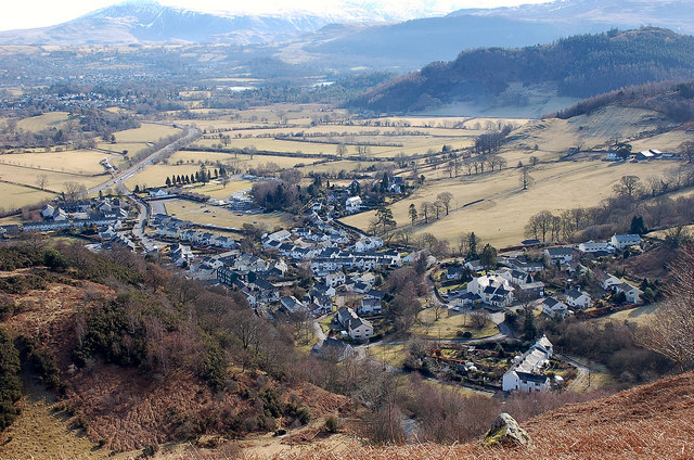
Image: © Jim Barton Taken: 10 Mar 2010
The steep side of Kinn affords an aerial view of the village of Braithwaite, with the busy A66 away to the left, towards Keswick.
Images are licensed for reuse under creativecommons.org/licenses/by-sa/2.0
Image Location
Latitude
54.601874
Longitude
-3.192059