Approach to Stonehouse Bridge
Introduction
The photograph on this page of Approach to Stonehouse Bridge by Colin Vosper as part of the Geograph project.
The Geograph project started in 2005 with the aim of publishing, organising and preserving representative images for every square kilometre of Great Britain, Ireland and the Isle of Man.

There are currently over 7.5m images from over 14,400 individuals and you can help contribute to the project by visiting https://www.geograph.org.uk
Approach to Stonehouse Bridge
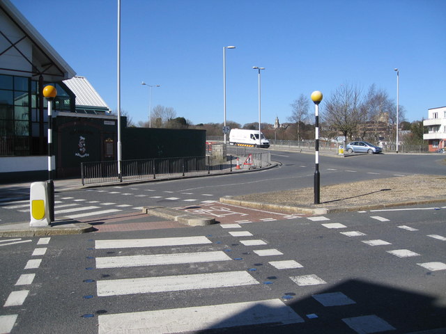
Image: © Colin Vosper Taken: 10 Mar 2010
The road going off centre left of the photo, where the white van is, is Stonehouse Bridge which was formerly was a toll bridge known as 'ha'penny' bridge. Now it is the route of the A374 through Plymouth and is a busy and main highway. There is definitely a need for the pedestrian crossings on the approach roads here. There is one relic of significance barely visible which is the memorial to those of the old brewery company who lost their lives in the 'Great War 1914 - 1919' ... the First World War. The wall containing the memorial can just be seen between the belisha beacon and the lamp post to the left of centre. The wall is now alongside the premises of the lucky yacht and motor boat builders ~ 'Princess Yachts'. Image At the centre of the photo, but difficult to seen, is a small alleyway beside the south side of the bridge limestone abutments giving public access down to the water of the creek. Image
Images are licensed for reuse under creativecommons.org/licenses/by-sa/2.0
Image Location
Latitude
50.369268
Longitude
-4.163466