Throwleigh - The Commemorative Cross and street view
Introduction
The photograph on this page of Throwleigh - The Commemorative Cross and street view by Colin Vosper as part of the Geograph project.
The Geograph project started in 2005 with the aim of publishing, organising and preserving representative images for every square kilometre of Great Britain, Ireland and the Isle of Man.

There are currently over 7.5m images from over 14,400 individuals and you can help contribute to the project by visiting https://www.geograph.org.uk
Throwleigh - The Commemorative Cross and street view
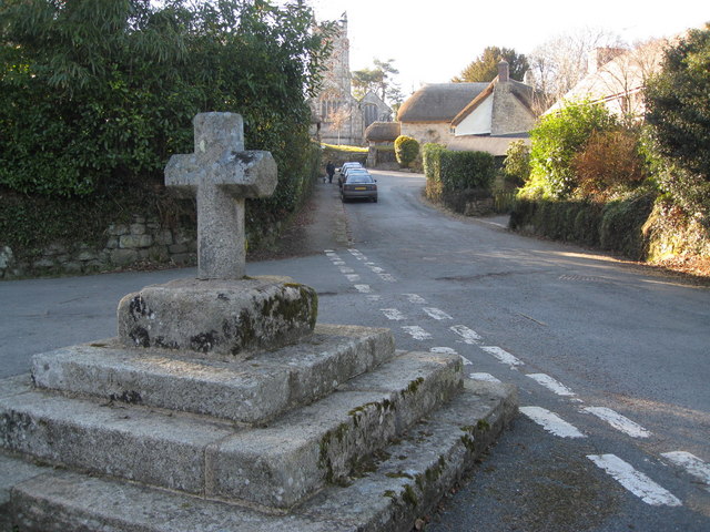
Image: © Colin Vosper Taken: 8 Mar 2010
The centre of Throwleigh (pronounced: Throwl-eigh) showing site of an ancient cross but now lost and replaced with one that commemorates Queen Victoria's Diamond Jubilee in 1897. The photograph also contains a glimpse of the church at the far end of the village street. It is known locally that this location at the stone cross in the centre of the village was a wonderful meeting place for villagers in days gone by, especially for the men on a Sunday afternoon. Church in the morning and chatting in the afternoon on their "Day of Rest". Image
Images are licensed for reuse under creativecommons.org/licenses/by-sa/2.0
Image Location
Latitude
50.701277
Longitude
-3.887265