Braeminzion
Introduction
The photograph on this page of Braeminzion by Anne Burgess as part of the Geograph project.
The Geograph project started in 2005 with the aim of publishing, organising and preserving representative images for every square kilometre of Great Britain, Ireland and the Isle of Man.

There are currently over 7.5m images from over 14,400 individuals and you can help contribute to the project by visiting https://www.geograph.org.uk
Braeminzion
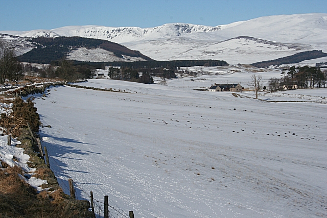
Image: © Anne Burgess Taken: 2 Mar 2010
Braeminzion is one of the few farms in the glen which are situated on the low ground beside the River South Esk. The two craggy corries on the skyline are the ones above Loch Brandy on the left and Loch Wharral on the right.
Images are licensed for reuse under creativecommons.org/licenses/by-sa/2.0
Image Location
Latitude
56.789306
Longitude
-3.040392