Baggrow station site
Introduction
The photograph on this page of Baggrow station site by Ben Brooksbank as part of the Geograph project.
The Geograph project started in 2005 with the aim of publishing, organising and preserving representative images for every square kilometre of Great Britain, Ireland and the Isle of Man.

There are currently over 7.5m images from over 14,400 individuals and you can help contribute to the project by visiting https://www.geograph.org.uk
Baggrow station site
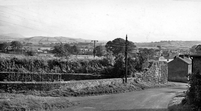
Image: © Ben Brooksbank Taken: 25 Sep 1961
Southward view at site of Baggrow station (former Aspatria - Mealsgate - Wigton line), closed September 1930: in middle distance (left), Binsey (1,486 ft.), on horizon, Skiddaw (3,054 ft.).
Images are licensed for reuse under creativecommons.org/licenses/by-sa/2.0
Image Location
Latitude
54.765941
Longitude
-3.275526